
The following input is made in this group box:
-
"Designation"
The entered designation is displayed by default directly above the corresponding stratigraphic log in the drawing. The name of the stratigraphic log can be forced into two lines by entering the "#" sign (e.g. "RCS 1#2010-20-06"). The text in the second line automatically uses a smaller font size. -
"Height"
For the height input of the stratigraphic log (= top of sounding) a number must always be entered first, as this value serves as the y coordinate for graphical representation. If you use negative numbers, no space is allowed between the minus sign and the number. For description of height a text may be entered, with one space distance to the number, e.g. "m AD". You may also do without text input. A height labelling with a text in front such as, e.g. "AD +34.30 m", can be activated using the "Preferences/General" menu item. The default position of the height data is below the name of the stratigraphic log.
The alignment and respective distances in [mm] to the top of the stratigraphic log of the log's designation and height can be modified using the "Designation/height prefs." button in the log's general data editor box. If the alignment and distance of names and elevation data for all stratigraphic logs in a file (= geological section) need to be uniformly adopted, this can be done using the "Apply to all" button ("Designation/height" tab) in the "Input/Stratigraphic log" dialog box. Another option for positioning the name and elevation of all existing stratigraphic logs can be found in the "Preferences/General" menu item. However, this also impacts all other input elements, e.g., dynamic probings, wells, or cone penetration tests.
In order to have the stratigraphic log visible in the drawing, the lower drawing margin must be correctly set in the "Input/Overall view" menu item.
-
"x"
Input of the location of the stratigraphic log in x-direction is measured from the left page margin in metres in the scale of your drawing. If you have selected a scale in x-direction of 1:100, entering the number "5.0" will mean that the stratigraphic log will be displayed 5 cm (= 5 m) from the left page margin. -
"Width"
The display width of the stratigraphic log is also defined in metres in the scale of the drawing. At a scale of 1:100 in x-direction this means that the stratigraphic log is displayed 1 cm wide for a width of "1.0". -
"To the right"
The default position for layer labelling is at the right of the log. Layer labelling can be forced to the left side if this check box is deactivated. The alignment of all the stratigraphic logs in a file (= geological section) can be activated using the "Apply to all" button ("Short text/soil group" tab) in the "Input/Stratigraphic log" dialog box. -
"Height displ."
By entering a height displacement it is possible to display several logs above each other on a single sheet. This does not alter the actual height or depth data. They are still displayed exactly as they were surveyed (see figure below).
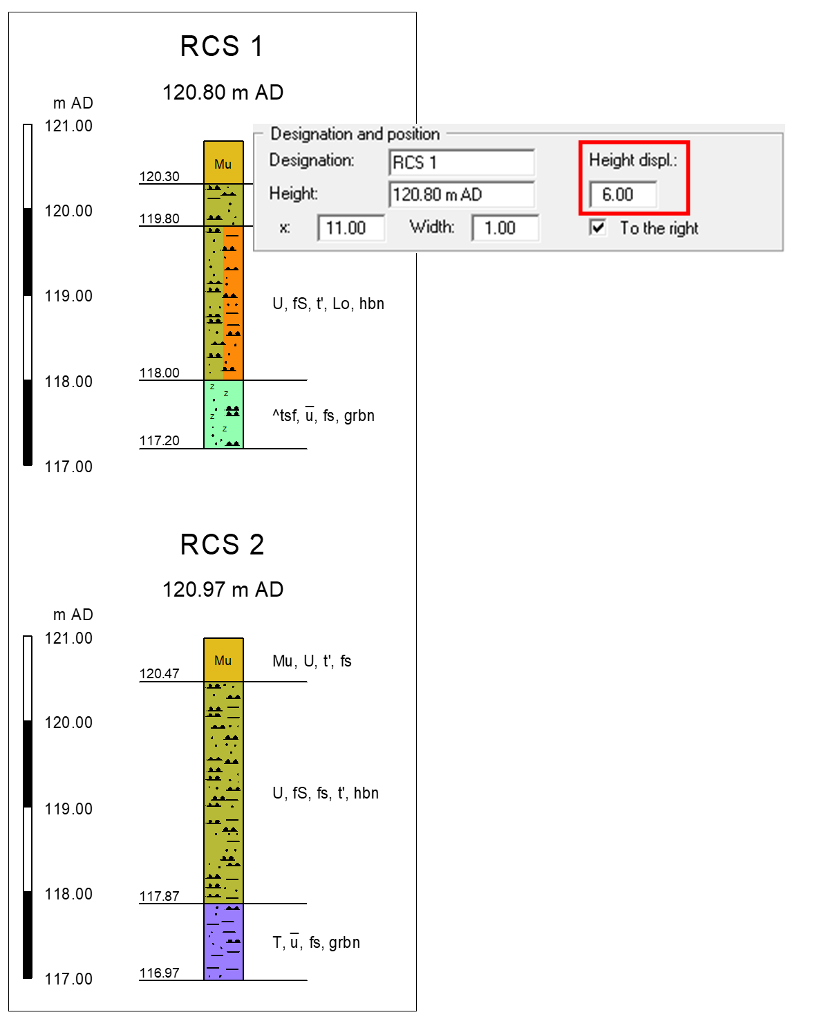
The second reference staff with the same height displacement can be used for the above log RCS 1 (see also "Edit/Select" and "Input/Reference staffs" menu items).