
The following groundwater input options are available:
-
Groundwater at "Bore end", "Drilled at", "Undisturbed"
Input relating to the groundwater table is made in metres measured from the top of the log (= m below grade). After the measured depth a text may be entered (e.g. the date), with one space distance to the number. The text is entered in the drawing below the groundwater line.
If a negative number is entered no groundwater table is shown. The default value in all groundwater input boxes when the program starts is therefore -1.
If the groundwater table for the stratum is interpreted from the SEP 2 abbreviations it is automatically entered in the appropriate groundwater line, depending on the abbreviations used.
The groundwater table is displayed with the groundwater symbol corresponding to the input line. If enough space is available an increase or a drop are indicated by an arrow. -
"Distance"
With your input, you can control the distance of the groundwater labelling from the stratigraphic log. The distance can also be modified to apply to several stratigraphic logs by pressing the "Apply to all" button ("Groundwater + left texts" tab) in the "Input/Stratigraphic log" dialog box. -
"More"
Using this button you can define three further groundwater levels.
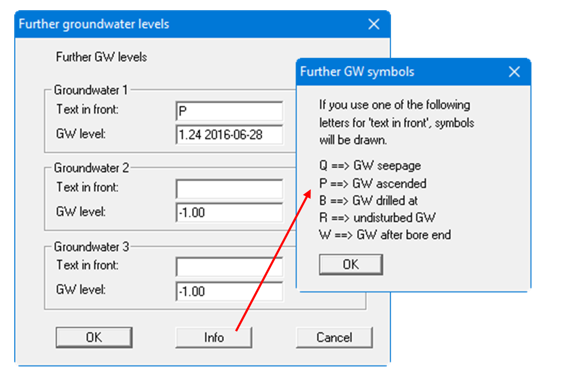
It is possible to enter the measuring date, for example, after the measured values, at one space. If the appropriate, defined letter is entered in the "Text in front" box a groundwater symbol is displayed. The letters are explained in a further dialog box after pressing the "Info" button.