
If the coordinates of the data points and the corresponding data are available as an ASCII file, this data can be read into the program. You can either read the data as "new" values (the current data will be deleted) or append it to the current data. Decimal fractions must have a point and not a comma. After selecting the ASCII file, you will see a dialog box:
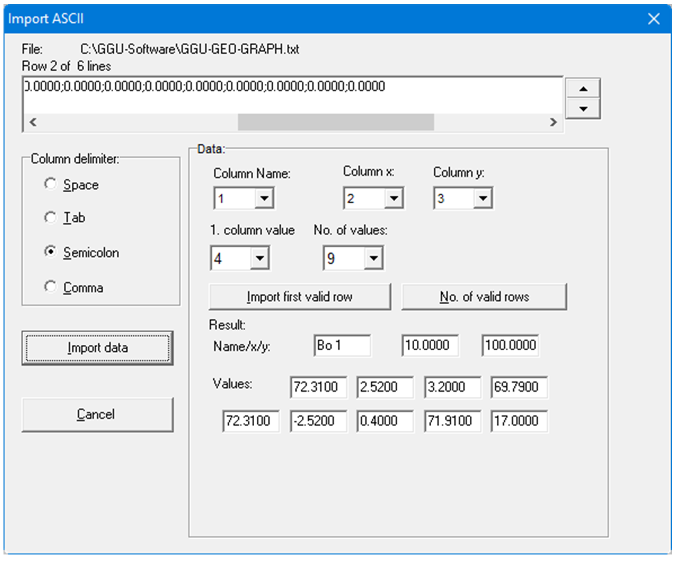
The current row of the ASCII file is shown at the top. You can move through the file using the arrow buttons on the right. In "Column name:", "Column x:", "Column y:" and "1st column value" you denote the column number containing the corresponding information. In "No. of values:" you enter the number of values associated with a respective data point. The data for the selected row are displayed at the bottom. If all the information is correct, the result for the row is shown at the bottom right of the dialog box after clicking the "Import first valid row". Otherwise, "Error" appears.
You may need to change the column delimiter.
If the file contains invalid as well as valid rows, these will simply be skipped during reading. After the "Import data" button has been pressed and the data successfully read, you will see a message box with the number of values and character strings imported. The data can now be processed further.