
Select the "Layers" menu item from the "Editor 2" menu. A layer always consists of two coordinate pairs. Unlike many other programs, with GGU-STABILITY it is not necessary to enter a polygon course across the whole width of the system. Each layer has a soil number which is used to describe the soil properties (see second dialog box in Section “Step 7: Enter soil properties (Ex. 1)”). These soil properties are valid above the two coordinate pairs, as far as the surface line, or as far up as the base of a further layer. After input the layers are sorted automatically by depth and numbered. The soil number assigned to a layer is unaffected by the layer numbering (see Figure 4).
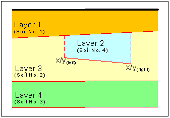
During input, observe that the layer boundaries may not cross. Nor are they allowed to intersect the surface. Both of these conditions are checked by the program immediately after layer input. Erroneous input is corrected or rejected, and an error message displayed.
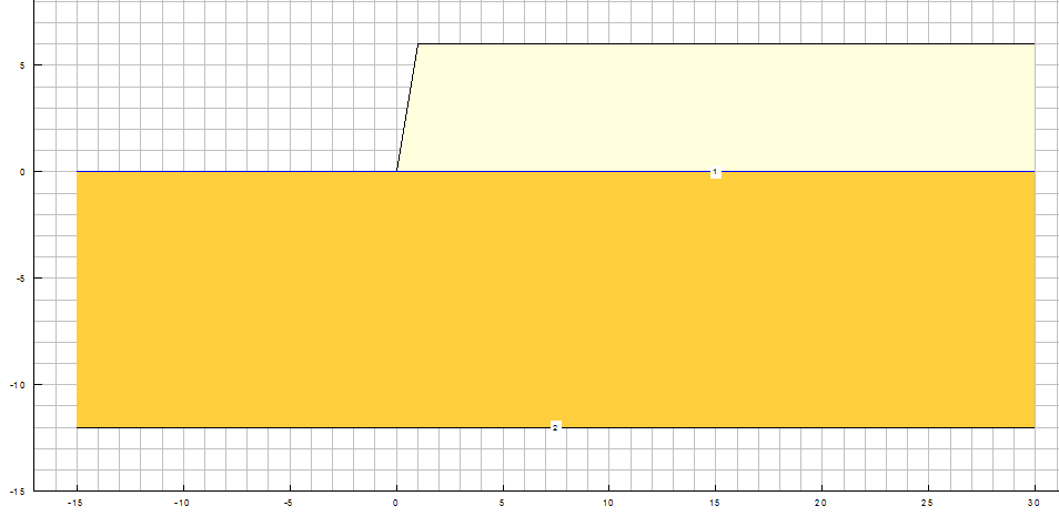
For this example, select two layers with the coordinates:
-
Layer 1 with soil number 1
x/y (left) = 0.0/0.0
x/y (right) = 30.0/0.0 -
Layer 2 with soil number 2
x/y (left) = -15.0/-12.0
x/y (right) = 30.0/-12.0
The soil colours can be modified in the soil properties legend. Click in the legend using the left mouse button and then on the "Colours" button in the opened editor box (see menu item "Editor 1/Soil properties legend").