If you work with eastings and northings a lot of digits are lost numerically, because the coordinate values only differ in the final four digits before the point.
It may then be expedient, and in extreme cases unavoidable, to work with a so-called offset. For example, you can subtract 3,550,000 m from all eastings between 3,555,000 m and 3,556,000 m and then work in the range from 5,000 m to 6,000 m. You can make this offset visible in the graphics by correspondingly labelling the x and the y axis (see menu item "Page size + margins/Labelling x and y axes").
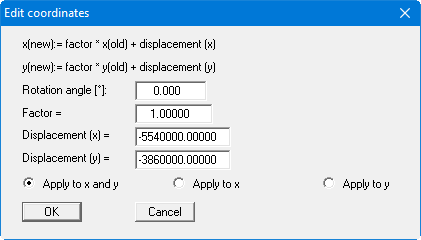
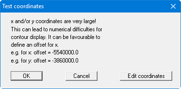
If the coordinates are too large, the above dialog box opens, for example. The "Edit coordinates" button opens the same box as used in the menu item "Edit/Edit point coordinates". However, the program enters the recommended offset values directly into the appropriate input boxes.